Rail Series Part 1: Corridor to Company Town
Desert Crossroads
The Mojave Desert, an unforgiving expanse between Southern California and Utah, contained a rare concentration of springs in a valley known as “Las Vegas,” and that dependable water source made it a natural stopping point long before steel rails turned it into a railroad town. Indigenous travel routes, the Old Spanish Trail, Mormon migration routes, and later U.S. Army surveys gradually defined a corridor across this desert landscape.
The Springs That Made a Corridor
Three artesian springs broke through the desert floor at the center of the Las Vegas Valley, feeding two pools and a creek that ran eastward across the valley floor. The springs drew from a deep aquifer recharged by snowmelt in the surrounding mountains, and they flowed year-round — a rare and dependable certainty in a landscape defined by scarcity. The Southern Paiute people used the springs as a seasonal base and travel waypoint for centuries before European exploration reached the region.
The valley sat roughly midway along the most practical overland route between the Colorado River crossings to the east and the passes into Southern California to the west. A traveler or anyone planning to haul a load faced a journey that crossed several hundred miles of desert with few reliable water sources. Knowing that water would be available at a specific, fixed location allowed for the calculation of loads, the sizing of parties, and the spacing of rest stops that made the route viable for commercial and military use. Without that fixed point, the corridor was a gamble. With it, the corridor became a schedule.
From Trail to Survey Line
When U.S. Army Corps of Topographical Engineers officer John C. Frémont camped at the Las Vegas Springs on May 3, 1844, he spent a single night. His journal entry and map, published by Congress in 1845 in an edition of 20,000 copies, converted a trading waypoint into a documented, cartographically fixed location.
The Old Spanish Trail did not run in a straight east–west line; it curved to follow water and workable terrain, and that routing brought traffic through the southern Nevada corridor near the Las Vegas Springs. The trail carried organized commercial traffic — wool and woven goods, horses and mules — moving between New Mexico and California markets rather than merely casual travel. The mule trade that had relied on the springs was now fixed on the government’s map, and federal planners were evaluating railroad routes. Although the first transcontinental railroad would ultimately be built farther north, the Las Vegas corridor had entered the national transportation conversation and would not disappear from federal consideration.
Within a decade, the same Corps was conducting the Pacific Railroad Surveys of 1853 to 1855 — federal evaluations of potential transcontinental railroad routes through the corridor. Survey reports documented reliable water at the springs and workable grades through the valley — a technically viable corridor, even if not the chosen one.
The First Attempt at Infrastructure
By the mid-1850s, a Mormon expedition deliberately selected the springs as its destination rather than as a stop along the route. In 1855, the Church of Jesus Christ of Latter-day Saints established a mission at Las Vegas. They built an adobe fort near the springs, planted crops, and set up a provisioning stop on the corridor between Salt Lake City and Southern California. At that time the corridor carried Mormon migration and supply wagons between Utah settlements and Southern California outposts, along with military survey parties and occasional livestock drives. It failed within three years. The soil was alkaline. The crops did not produce. By 1858 the missionaries were gone. The fort stayed. The corridor stayed. They recognized that the springs justified a permanent way station at that location. It took almost another fifty years and a different technology to prove it. The site did not sit idle. Over the following decades it passed through several occupants and functioned as a working ranch, until Helen Stewart sold the land and water rights to Montana Senator William A. Clark in 1902.
The Railroad Arrives
When Clark purchased the 1,800 acre Stewart Ranch for $55,000, he also got the Las Vegas Springs and the old abandoned Mormon Fort. He was building the San Pedro, Los Angeles & Salt Lake Railroad between the port of Los Angeles and Salt Lake City. The springs were not incidental to the purchase. They were the point of it.
In the arid Southwest, water rights were not a utility. They were the precondition for settlement. Whoever held the water determined where a town could exist, how large it could grow, and under what terms. Clark did not simply buy land. He bought the condition on which everything else depended.
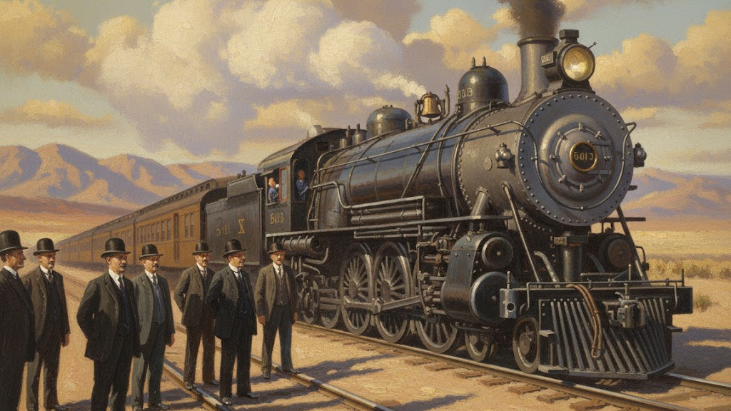
A steam railroad required water at regular intervals, and the Las Vegas Springs sat where a division point made operational sense — a facility for servicing locomotives, housing crews, and staging freight. Tracks reached Las Vegas from Utah in October 1904 and from California in January 1905.
A division point was not simply a stop. It was a fully equipped service facility. In 1905 that meant water tanks to replenish locomotive boilers, coal storage for fuel, a roundhouse for engine inspection and repair, crew change facilities where one set of engineers and firemen ended their run and another began, a telegraph office for dispatching, and freight staging areas where cargo was sorted, held, and transferred between trains. A railroad could not operate a line of any length without these facilities at regular intervals. Las Vegas became one of those required intervals. On the Salt Lake Route, Las Vegas sat between the line's northern operations toward Caliente and Salt Lake City and the Mojave segment leading south toward Yermo and the Los Angeles Basin.
The Townsite and the Auction
On May 15, 1905, the railroad auctioned lots on a surveyed townsite. Las Vegas was not a settlement that had grown organically. It was a planned operational node on a railroad line. The railroad formed a subsidiary, the Las Vegas Land and Water Company, to administer the townsite and control the water. The springs that had organized travel through the corridor for centuries were now a corporate asset.
The railroad platted a 40-block townsite east of the tracks, advertised lots in Los Angeles and Salt Lake City, and transported buyers to the sale on its own trains. C.O. Whittemore, president of the Las Vegas Land and Water Company, presided over the two-day auction. Lot deeds carried conditions: the railroad controlled land use, guaranteed water service to every lot, and restricted liquor sales to designated blocks. The two-day sale generated approximately $265,000. Buyers purchased not just land but access to railroad infrastructure — water, streets, and employment. Walter Bracken, the railroad's local agent, would administer that infrastructure for the next two decades.
A competing townsite emerged west of the tracks when developer J.T. McWilliams platted lots independent of the railroad. But McWilliams did not control the springs. The railroad did. Without guaranteed access to water infrastructure, the west-side townsite struggled to attract permanent investment. By 1906, most commercial activity had consolidated east of the tracks near the depot, where water service and rail access were assured. The competition ended not with rhetoric but with plumbing. Control of water decided the map.
The Depot as Economic Center
Businesses clustered near the depot immediately. Passengers arriving by train needed hotels, meals, and supplies. Freight moving through the division point needed handlers, storage, and local distribution. The intersection of Main and Fremont became the commercial core not by planning preference but by the concentration of foot traffic and freight movement that the depot generated. The railroad was the town’s dominant employer and its primary economic engine in its early years.
Incorporation, 1911
Las Vegas incorporated as a city in 1911. The railroad had created the town; the next installment examines what happened when that railroad town began to govern itself.
Sources
The following sources document the historical development of the Las Vegas corridor, the role of the springs, and the railroad construction that established the townsite.
-
History of the Springs Preserve . Springs Preserve, Las Vegas, Nevada.
Primary institutional source for the physical description, annual flow volume, Southern Paiute use of the springs prior to European contact, and the 1962 cessation of surface flow.
-
Las Vegas Springs . Wikipedia.
Physical description of the three springs, two pools, and artesian character of the site.
-
Las Vegas Springs Historical Marker . Historical Marker Database.
Source for the Mormon mission date of 1855, the alkaline soil failure, and the 1902 railroad purchase of the springs and water rights.
-
John C. Frémont's One-Night Stand in Las Vegas — 180 Years Ago This Week . William P. Barrett, New to Las Vegas.
Source for Frémont's May 3, 1844 camp at the Las Vegas Springs and the Congressional publication of his map and report in 1845.
-
About the Surveys — United States Pacific Railroad Surveys . National Museum of American History, Smithsonian Institution.
Source for the Pacific Railroad Surveys of 1853–1855 conducted by the U.S. Army Corps of Topographical Engineers to evaluate transcontinental railroad routes.
-
Union Pacific Railroad Collection . UNLV Special Collections and Archives, University of Nevada, Las Vegas.
Primary source for the 1902 Stewart Ranch purchase, the construction timeline, and the formation of the Las Vegas Land and Water Company.
-
San Pedro, Los Angeles and Salt Lake Railroad . Online Nevada Encyclopedia.
Source for the $55,000 purchase price of the Stewart Ranch, the 1,800 acres, and Clark's acquisition of the Las Vegas Springs and water rights from Helen Stewart in 1902.
-
Clark's Las Vegas Townsite Auction . Online Nevada Encyclopedia.
Source for the auction mechanics, C.O. Whittemore's role, and the approximately $265,000 total generated by the two-day sale.
-
San Pedro, Los Angeles and Salt Lake Railroad Company Records . UNLV Special Collections and Archives, University of Nevada, Las Vegas.
Corporate records documenting the platting of the townsite, the lot auction, and the creation of the Las Vegas Land and Water Company.
-
Old Spanish Trail . Legends of America.
Source for the commercial character of the Old Spanish Trail and trade between New Mexico and California.
-
Fremont Street . The Historic Las Vegas Project.
Source for the townsite grid orientation parallel to the railroad and the depot at Main and Fremont as the town’s early center.
-
Early Las Vegas . American Experience, PBS.
Source for the McWilliams townsite competition west of the tracks and the railroad’s control of water as the decisive advantage.
-
Nevada History Timeline . Nevada Landmarks.
Source for the January 30, 1905 completion of the San Pedro, Los Angeles and Salt Lake Railroad.
Leave a Comment
Comments are reviewed before they appear publicly.